

How Do GPS Cattle Collars Work?
A practical guide to 4G connectivity, solar power and virtual boundary management.
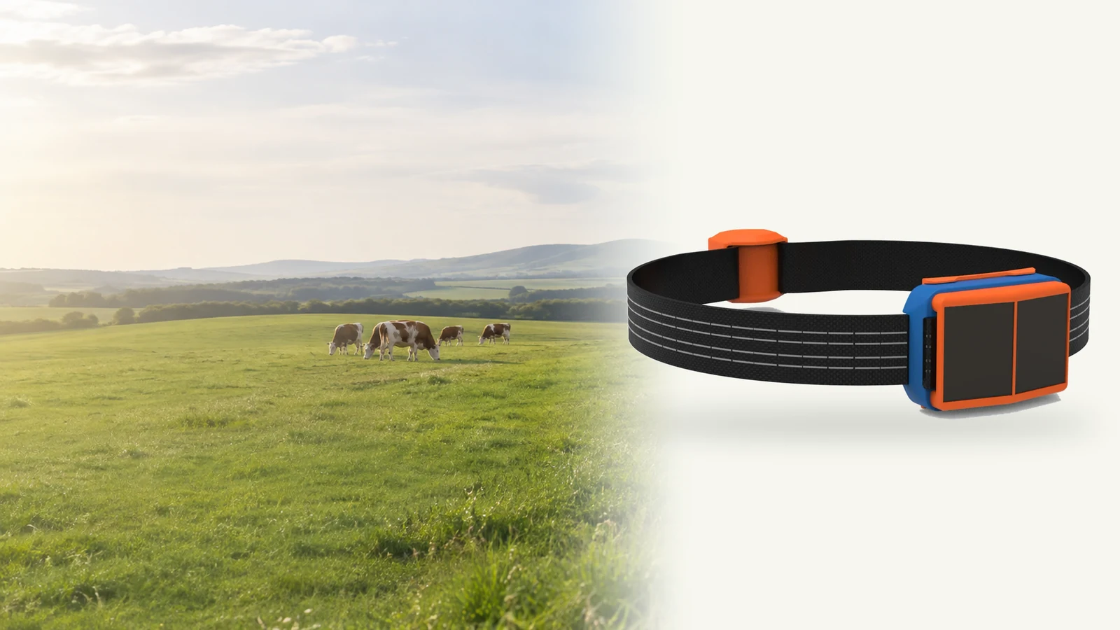
A GPS cattle collar brings together several functions: finding an animal’s position, sending information to a platform and providing records that a grazing team can use. The Fullanim C006 GPS Collar combines BeiDou/GPS positioning, 4G reporting, solar energy harvesting, movement monitoring and virtual boundary management.
The important distinction is simple: satellites help determine position; the mobile network carries the data. C006’s reported positions reach the Web / App platform through compatible local 4G networks, not through a satellite messaging connection.
For a grazing project, the useful questions go beyond whether a collar has GPS. How will reports reach the team? How will power be replenished? What happens when an animal crosses a configured boundary? This guide explains the workflow and what to check before a wider rollout.
From Collar to Dashboard
Satellite positioning
C006 uses BeiDou/GPS to determine livestock positions. Its published positioning accuracy is 2 m, but that figure should not be treated as a guarantee for every reading in every pasture. As explained in GPS.gov’s guide to GPS accuracy, satellite visibility, signal blockage and receiver characteristics can affect positioning performance.
During evaluation, compare reported positions with known locations in the areas animals actually use. Include open ground, sheltered spots and areas close to the intended grazing boundaries.
4G data reporting
C006 sends its reports through a compatible mobile network to the agreed backend and application services. The architecture is:
C006 collar → compatible 4G mobile network → backend / application services → Web / App.
GPS positioning and remote data access are different parts of that workflow. Do not assume that a GPS fix means a fresh position has already reached the dashboard. In a pilot, inspect timestamps and agree how old a report can be before it is no longer useful for the intended task.
Platform access and local delivery
The C006 offering includes hardware and software from Fullanim, while local partners arrange mobile service, deployment and customer support. Fullanim also supports data interfaces and integration with customer platforms, with the integration scope confirmed for the project.
Before ordering, identify who will provide connectivity, configure the application, onboard users and respond when a device stops reporting. A clear responsibility split belongs in the deployment plan, not just in the sales discussion.
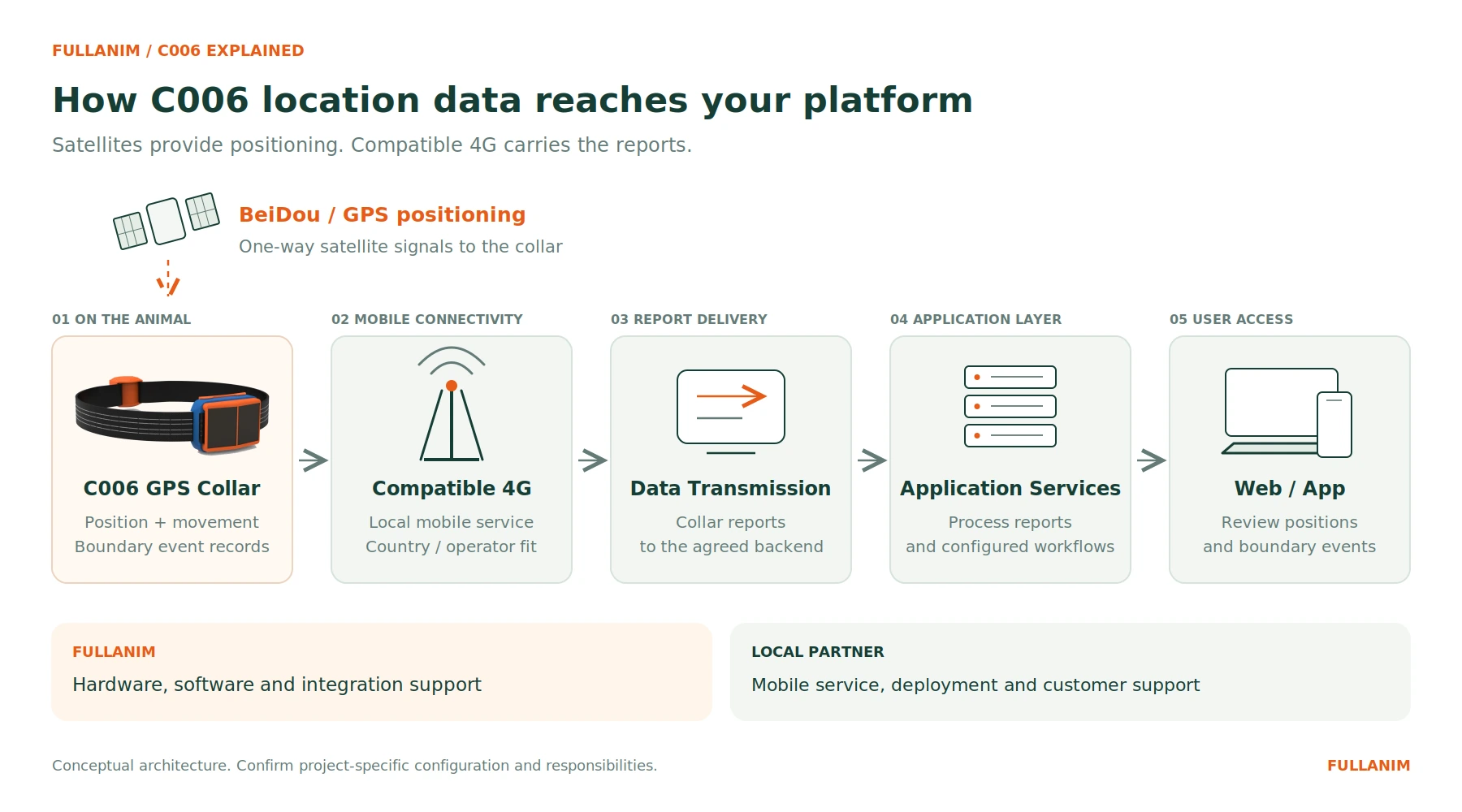
BeiDou/GPS provides positioning; compatible 4G carries reports to the platform. Conceptual architecture.
What 4G Means for Deployment
The C006 reporting path uses compatible mobile coverage rather than the LoRaWAN gateway link used by the Fullanim T005 GPS Ear Tag. This changes the network-planning question: for C006, start by evaluating the local mobile service across the grazing area.
Ask the supplier and local connectivity partner to confirm:
- The intended country, operator and supported device configuration.
- The supported cellular bands and relevant operator acceptance requirements.
- Mobile-service provisioning, account ownership and recurring charges.
- The reporting interval and the expected time from capture to display.
- What the selected firmware does during coverage loss and after reconnection.
Do not assume that a coverage map or a phone check alone completes the assessment. Test the actual collars on the intended service and review reporting across representative locations. Confirm offline storage and later retransmission explicitly if the project requires them; they should not be assumed from the presence of GPS.
What Solar Power Changes
C006 harvests solar energy to replenish power during sunlight exposure, helping reduce manual charging and battery-maintenance work. For the project team, the goal is to reduce power-servicing visits—not to remove power management from the deployment plan.
The published specification lists a nominal operating duration of 60 months and 15 days of normal operation without light. These describe different operating conditions: 60 months is not a claim of five years without sunlight or charging.
Before relying on either figure, request the applicable test conditions and configuration. The pilot should examine reporting settings, starting charge, local weather, shading, panel orientation and the maintenance routine. Ask how the proposed configuration will be assessed during a period of poor sunlight.
Treat solar power as a reason to evaluate a longer-term outdoor deployment, not as a promise of unlimited energy or maintenance-free use.
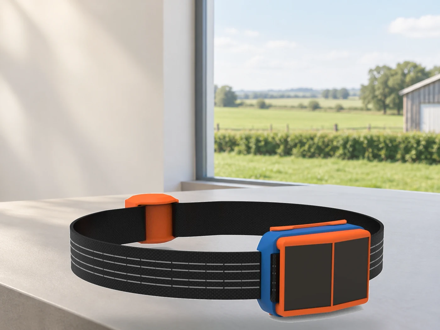
Solar energy replenishes power during sunlight exposure, helping reduce manual power servicing. Illustrative product composite.
Virtual Boundaries and Field Action
Fullanim describes C006 as supporting virtual boundary management, including records of persistent boundary breaches and event archiving after an animal returns within the boundary. These records can be reviewed alongside animal positions and movement information.
A useful way to structure the project is to separate three questions:
| Project question | What to establish |
|---|---|
| Where is the animal? | Position, timestamp and acceptable location uncertainty |
| What boundary event occurred? | Boundary configuration, breach criteria and event history |
| What action should follow? | Staff response, escalation and any separately confirmed animal-guidance functions |
The product’s published boundary-recording workflow should not be read as proof of a particular sound, vibration or electrical-stimulation mechanism. If active animal guidance is required, ask Fullanim to confirm the exact hardware, firmware, training process and safety controls before describing that capability to customers.
Likewise, do not treat a digital boundary as a guaranteed replacement for physical containment. Keep appropriate safeguards and check the rules for the intended market and configuration. For example, the Victorian Government’s announcement on virtual fencing requirements includes physical perimeter containment among its safeguards for approved electronic systems. This is a market-specific example, not evidence that C006 is approved there; check current local requirements before deployment.
In the pilot, agree which events require a field visit, who receives them and how the team confirms that an animal has returned. Boundary information becomes operationally useful when somebody owns the follow-up.
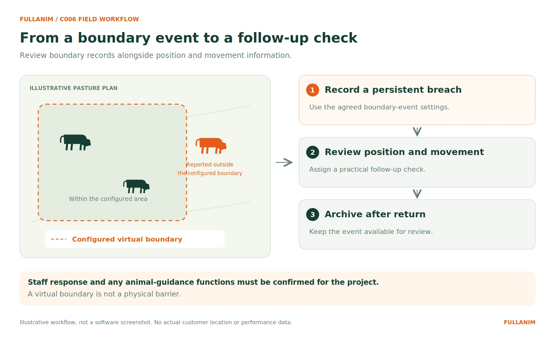
C006 supports boundary-event records and archiving after an animal returns. Illustrative workflow, not a software screenshot.
Movement Data in Context
C006 monitors movement levels and changes in daily activity alongside position and boundary records. Use this information as context for deciding which animals or areas deserve a closer check.
Do not turn a movement change into a disease, estrus or calving claim without a separately agreed and validated application. For routine evaluation, ask whether the data helps the team answer practical questions: Which animal should be checked? Where was it last reported? Is the change persistent enough to investigate?
A simple review workflow is often a better starting point than a long list of unverified alerts.
C006 Specifications at a Glance
| Item | Published C006 specification | What to confirm for the project |
|---|---|---|
| Positioning | BeiDou / GPS | Position performance in representative locations |
| Positioning accuracy | 2 m | Test conditions and the accuracy definition used |
| Connectivity | 4G | Country, operator, bands and mobile-service configuration |
| Power | Solar energy harvesting | Expected sunlight exposure and servicing arrangements |
| Nominal operating duration | 60 months | Applicable configuration, conditions and maintenance scope |
| Operation without light | 15 days of normal operation | Starting charge, reporting settings and test conditions |
| Total weight | Approximately 890 g, including the strap | Animal suitability, strap fit and inspection procedure |
| Monitoring | Position, movement levels and virtual boundary events | Required data fields, platform functions and response workflow |
Use these specifications to frame an evaluation, rather than substituting them for field acceptance criteria. Ask separately about reporting frequency, ingress protection, operating temperatures and certifications where the project requires them.
Collar or Ear Tag?
Within Fullanim’s range, C006 and T005 represent different device and connectivity approaches—not simply a larger and smaller version of the same tracker.
| Consideration | C006 GPS Collar | T005 GPS Ear Tag |
|---|---|---|
| Device format | Neck-worn collar | Ear tag |
| Communication | Compatible local 4G networks | LoRaWAN to a compatible gateway |
| Power approach | Solar energy replenishment in sunlight | Light-powered energy harvesting |
| Published monitoring focus | Position, movement and virtual boundary records | Location, automatic livestock counting, lying, walking and daily activity |
| First deployment question | Does the intended mobile service support the grazing area and device? | Where will gateway coverage and backhaul be provided? |
Start with the management task and local infrastructure. Evaluate the collar where its confirmed boundary workflow, fit and cellular reporting match the project. Evaluate the ear-tag architecture where a lightweight tag and a shared LoRaWAN network match the requirements. Neither connectivity approach should be called universally better.
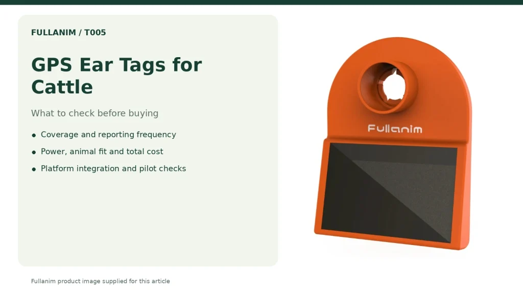
For a closer look at the alternative architecture, read how GPS cattle ear tags work, including the separate roles of satellite positioning, LoRaWAN reporting and light-powered operation.
Start With a Site-Level Pilot
Before a wider rollout, define acceptance criteria for the actual site:
- Map the task. State whether the priority is finding animals, reviewing boundary events, observing movement or combining those workflows.
- Verify reporting. Test the intended collars, mobile service and backend across representative grazing locations.
- Review power. Observe energy status under the agreed reporting settings and local sunlight conditions.
- Check fit. Follow the supplier’s fitting instructions, confirm suitability for the animals and schedule inspections.
- Exercise the workflow. Review permitted boundary test events, timestamps, return records and staff responses without exposing animals to unsafe situations.
- Agree ownership. Document who handles connectivity, platform administration, field support and ongoing maintenance.
For integrators and distributors, the pilot should also test onboarding and data integration. Define what a successful customer handover looks like before committing to deployment quantities.
Frequently Asked Questions
Does C006 transmit through satellites?
C006 uses BeiDou/GPS for positioning and compatible 4G networks for data reporting. Satellite positioning should not be confused with satellite messaging or a promise of remote reporting without cellular coverage.
Does C006 need a LoRaWAN gateway?
The published C006 reporting architecture uses a compatible 4G mobile network, not a LoRaWAN gateway. Fullanim’s T005 ear tag uses the LoRaWAN approach.
How often does it update?
Confirm the available C006 reporting settings and end-to-end delivery expectations with Fullanim for the selected configuration. Do not assume instantaneous tracking or apply an interval from another product.
Does solar power remove charging requirements?
Solar energy replenishes C006’s power while sunlight is available and is intended to reduce manual power servicing. Request a power assessment for the deployment conditions rather than assuming that charging and maintenance are never needed.
Can it connect to an existing platform?
Fullanim supports customer-platform integration and data interfaces, with the available interface and project scope confirmed during technical discussions. Share the required data fields, backend architecture and intended workflow before requesting an integration commitment.
Plan Your C006 Project
To evaluate a deployment, send Fullanim the target country, grazing-area information, livestock type, expected collar quantity, preferred mobile operator and platform requirements. Include the boundary workflow and reporting frequency the team needs.
Fullanim provides livestock hardware, software and technical collaboration, while local partners bring connectivity, deployment and ongoing customer services to their markets. Integrators and distributors can explore the Fullanim partner program to discuss the cooperation model.
Discuss your C006 project and request a project-specific quote.



 Contact us by email